Loading terrain & fire perimeter…
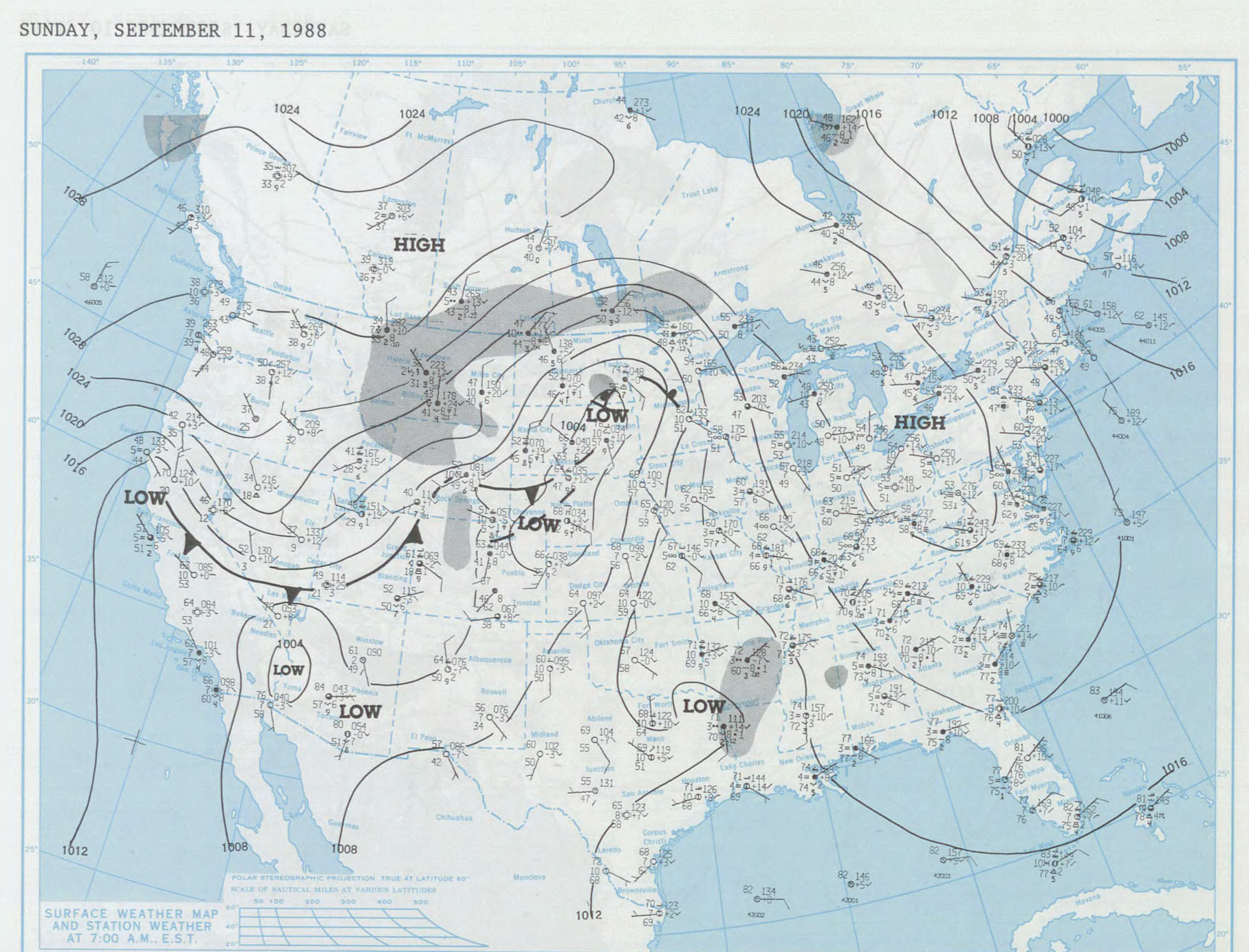
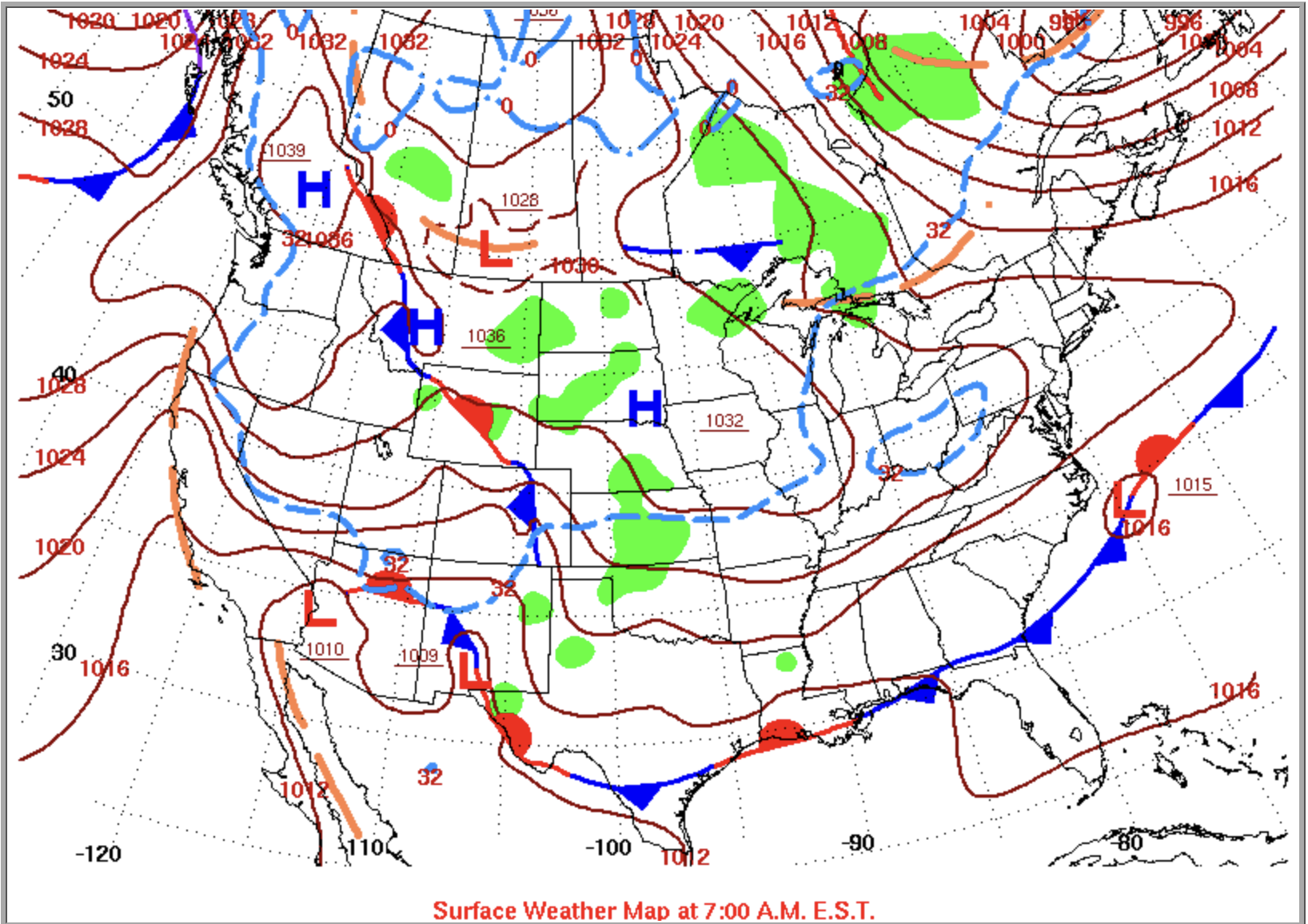
In the early morning hours of September 11th, 1988, a high-pressure system was streaming down from the Northwest into the Intermountain West, bumping into a low that had settled over the Southwest and another moving through the central valley of California. In the space between them — in that ladder of air pressing down from the high toward the waiting low — lay the gold country of the Sierra Nevada: Nevada and Yuba counties, the once-mining towns of Grass Valley, Nevada City, North San Juan, and Smartsville, and a growing lake community called Lake Wildwood.
"A 1036-millibar high sat broad-shouldered over the northern Rockies, its isobars drawn tight as a clenched fist, while a ragged cluster of lows pooled across the Desert Southwest."
The isobars running through the Sierra Nevada foothills were compressed and purposeful. The air had somewhere to go and nothing to stop it. Nevada City and Grass Valley lay precisely in the throat between them, in that narrow passage where the pressure gradient does its worst work.
The atmosphere does not improvise. It had arranged the same furniture it always arranges when it means business: the high to the northeast, the low to the south, and the mountains between them that take whatever is moving and make it move faster.
The wind and the pressure gradient were only half the story. The other half had been accumulating quietly since late 1986, one dry season at a time.
California's 1987 water year came and went without adequate precipitation. So did 1988. By the time September arrived, the Sierra Nevada foothills had been running a deficit for nearly two full years — the opening act of what would become one of the longest sustained droughts ever recorded in the state, a dry spell that would not fully relent until 1992.
Twelve California counties had already declared local drought emergencies by 1988, concentrated in the Central Valley and the northern foothills — the exact geography where the 49er Fire would find its footing. The reservoirs were low. The snowpack the previous winter had been thin and had vanished early. The soil held nothing. The grasses had cured weeks ahead of their usual schedule.
A drought does not simply reduce the water in the ground. It converts a landscape. What was marginal fuel becomes prime fuel. What was prime fuel becomes something closer to accelerant.
The chamise on the south-facing slopes, the manzanita in the draws, the accumulated needle cast beneath the ponderosa pines — all of it had spent two summers drying past any threshold that matters to fire behavior.
The fire that would ignite on the morning of the 11th simply found these conditions — patient, opportunistic, and entirely indifferent to the years of deficit that had prepared its path.
As the pressure gradient began to take shape, the winds switched from their usual southwest flow to out of the northeast. Twigs, needles, and the overall duff began to lose their moisture as dry adiabatic air moved over and down the Sierra peaks the way trouble moves — quietly, and then all at once.
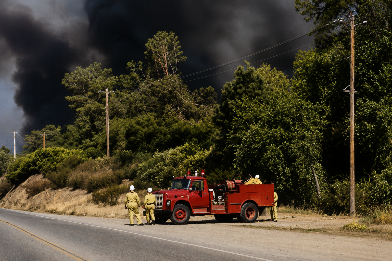
On the ridge above the South Fork of the Yuba River, the pines began to sway in a direction they did not favor. The crickets fell silent. The firefighters at the Columbia Hill CDF station — whether sleeping or merely attempting to sleep — kept one eye open, ready for the quick call, like sharks in the Pacific.
Weather stations began to show falling humidity levels, something that usually belonged to the heat of the day, not the dead of night. By three in the morning, power outages had begun to sprout across the area as lines and transformers lost their footing in the wind.
The lights of Nevada City flickered out here and there.
By approximately nine o'clock in the morning, Pacific time, the northeast winds were well established. The fuels were primed. The duff was powder. The chamise and manzanita on the south-facing slopes held their moisture the way a wrung cloth holds water — which is to say, they did not hold it at all.
All that was needed was the spark.
Gary Wayne Parris, an unhoused man sheltering in the margins of those old mining hills, was burning strips of paper bags. The tempest that was already unfolding around him was not interested in his intentions. One strip caught the wind. Then another.
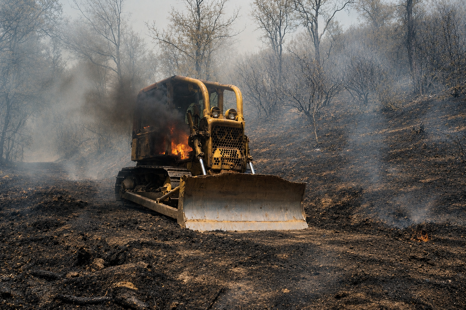
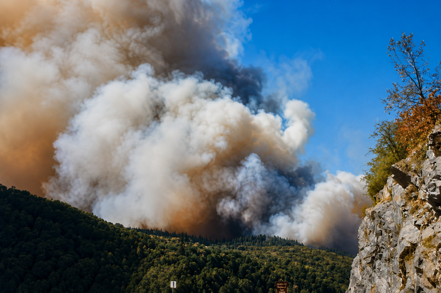
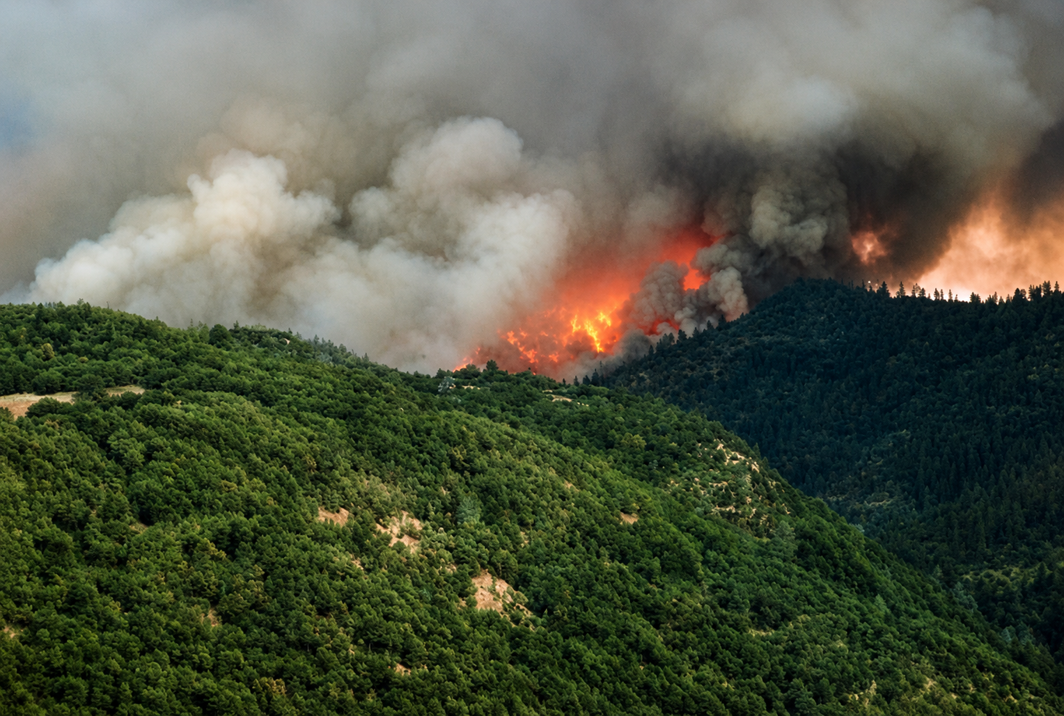
The fire that would bear the name of a highway and a gold rush era went to work on the landscape with the focused purpose of something that had been waiting a long time. It went down the canyons and up the ridges and through the pines and dry grass with the indifference of weather, which is the worst kind of indifference.
Burning past old mining claims, homesteads new and old — from northeast to southwest, starting from the high ridges near North San Juan and ending in the grassy flats west of Smartville, just shy of Beale Air Force Base.
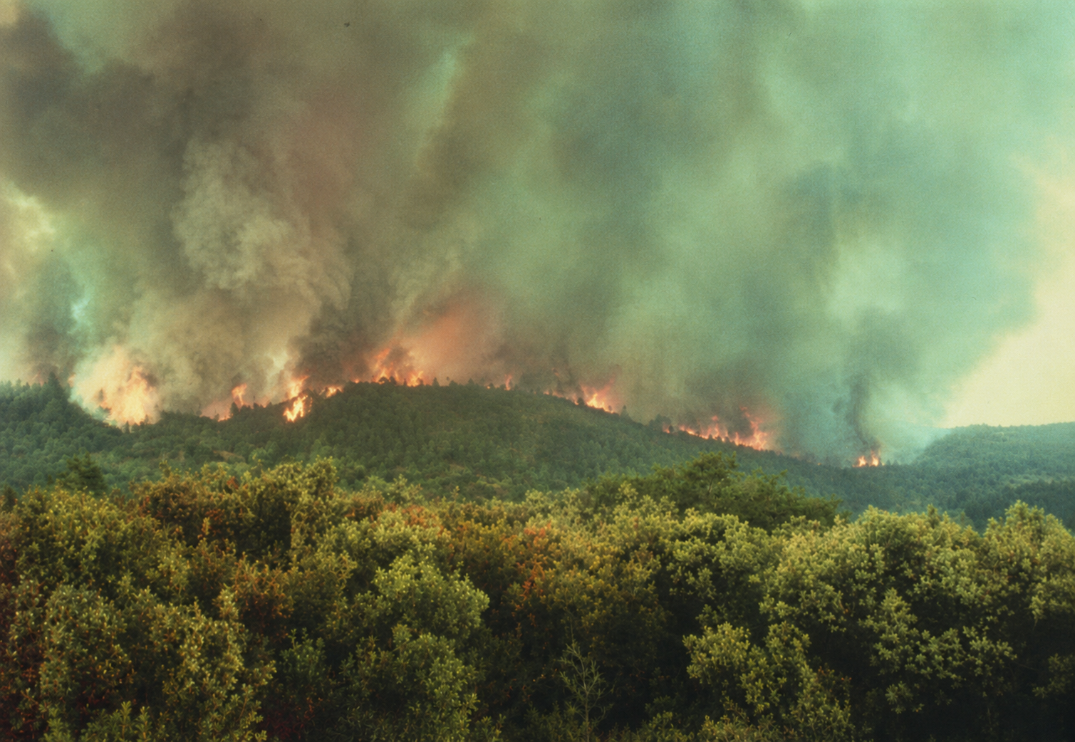
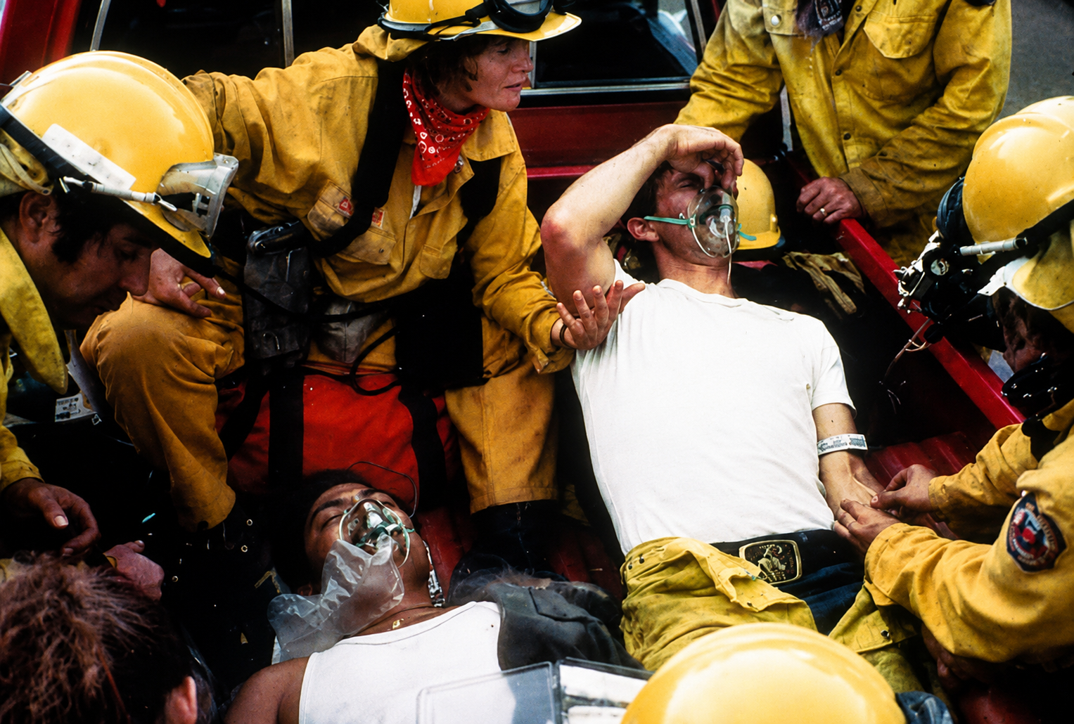
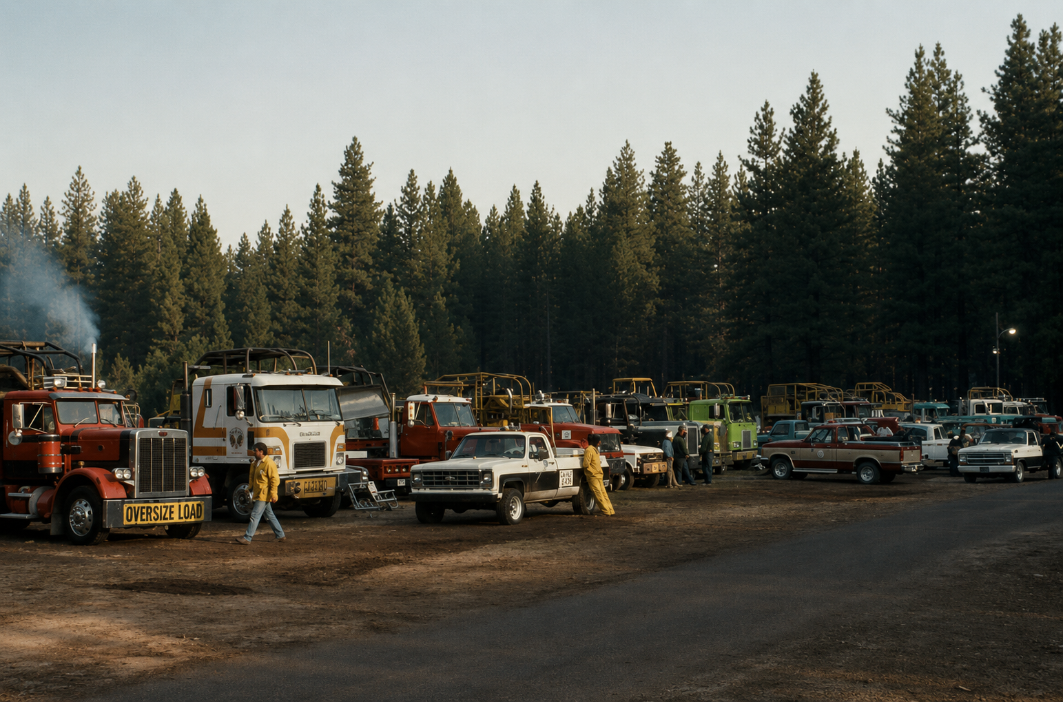
Circa photos — Sean Griffis · CAL FIRE
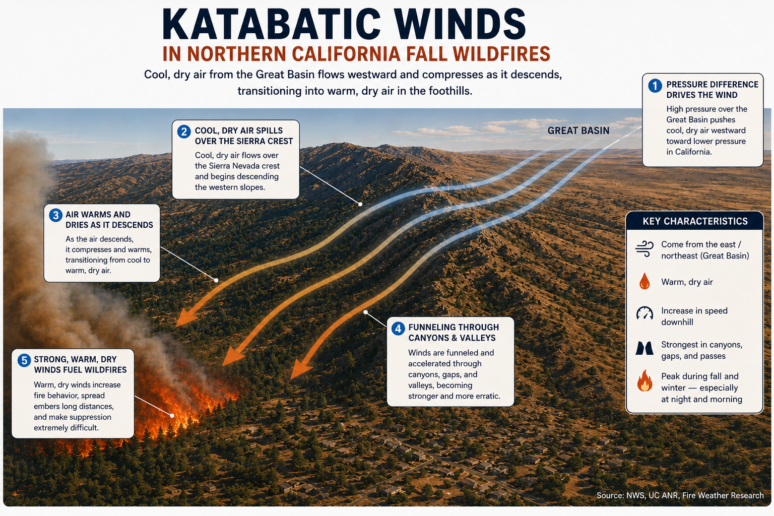
What those winds were, properly speaking, was katabatic — a word derived from the Greek katabatikos, meaning going downhill, which is precisely what they do and precisely what they were doing on the morning the 49er Fire was born.
Katabatic winds are a product of fundamental atmospheric physics. When a dense, cool or dry airmass accumulates over an elevated plateau or basin, its greater density relative to the air at lower elevations creates a pressure differential that gravity is only too willing to resolve. The air drains downslope through whatever topographic pathways are available — passes, canyons, river gorges — accelerating as those pathways narrow, in the same way that water accelerates through a constriction.
The mountains do not create these winds. They shape them, concentrate them, and deliver them to the lowlands with a force that the open plateau never suggested was possible.
In California, the eastern escarpment of the Sierra Nevada presents one of the more consequential katabatic corridors in North America. The Great Basin, sitting at elevation behind that escarpment, serves as the source region — a reservoir of cool, dense, continental air that accumulates particularly during the fall months.
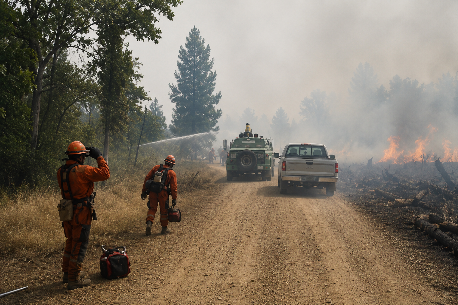
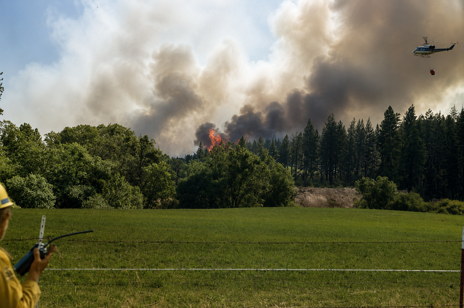
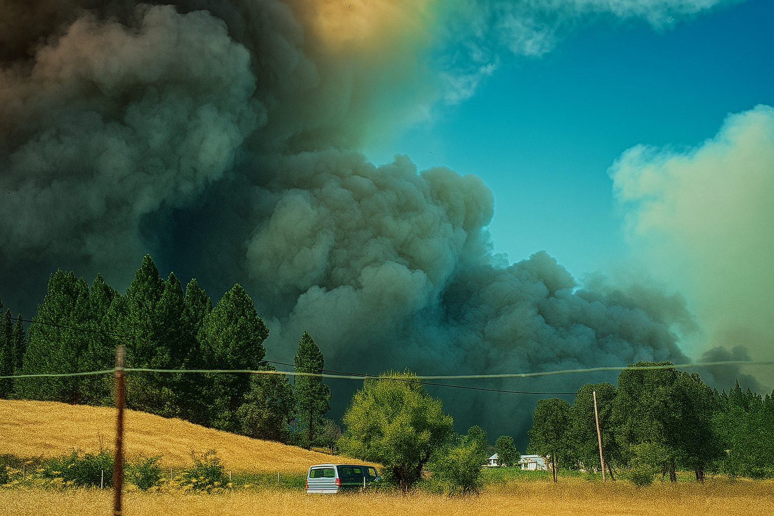
Circa photos — Sean Griffis · CAL FIRE
The process is further intensified by adiabatic compression. As the air descends from the high elevation of the Basin toward the lower elevations of the western foothills, it compresses under increasing atmospheric pressure and warms at the dry adiabatic lapse rate of approximately 5.5 degrees Fahrenheit per thousand feet of descent.
This warming is not a modest effect. Air that begins its journey as cool and relatively dry becomes, by the time it reaches the foothill communities of the Sierra Nevada, considerably warmer and dramatically drier. Relative humidity values that begin in the range of 30 to 40 percent in the source region can fall to single digits by the time that same airmass reaches the canyon mouths.
Whatever moisture remains in the surface fuels — the grasses, the duff, the accumulated needle cast beneath the pines — is extracted with mechanical efficiency. The fuels do not gradually become receptive to ignition. They become primed for it.
The synoptic pattern that drives these events is well understood and, in the context of California fire weather, distressingly familiar. It is common in the sense that meteorologists recognize it immediately when it appears on the charts. It is common in the sense that it recurs with regularity across the fall season, year after year, in the Sierra Nevada foothills and in the coastal ranges to the south. It is not common in the sense that its consequences are ordinary.
On the morning of November 8, 2018, a forecaster studying the surface map over Paradise would have felt a cold recognition.
A 1039-millibar high had anchored itself over the Pacific Northwest and the northern Great Basin — the same geography, the same posture, the same intent. To the south, the familiar lows had returned to the Desert Southwest, patient and waiting at 1009 and 1010 millibars. The isobars between them funneled northeasterly flow directly down the spine of the Sierra Nevada foothills, toward the ridge above the Feather River Canyon where Paradise sat among the ponderosa pines, unaware of what the map already knew.
The gradient was, if anything, sharper than it had been in 1988. The fuels were just as dry. The town in its path was larger. The fire ignited near Pulga and ran southwest — precisely along the gradient's preferred path — and by noon, Paradise was gone.
The Camp Fire had been built from the same blueprint as the fire that burned through the foothills of Nevada County three decades earlier.
The atmosphere had not changed its mind. It had simply waited for another morning when the high was in the right place and the low was in the right place and the mountains were, as they have always been, in between.
The gold country knows this. The ridge above the Feather River knew it too, in the end. What those hills have always had in common — the pines, the dry grass, the canyon winds, the duff that cures like tobacco through a long dry summer — is that they are ready before anyone asks them to be.
The spark is almost beside the point. The land is the point. The pattern is the point. And the pattern always comes back.
By the measures of what came after, the 49er Fire was small. Thirty-three thousand acres. Five days. A fire that burned hard and fast across the gold country foothills the way the gold rush itself once moved — with sudden, concentrated force, and then it was over.
Compare it to the Dixie Fire, which consumed nearly a million acres across three counties in the summer of 2021. Or the Biscuit Fire, 500,000 acres of southwest Oregon scorched in a single season. Those fires do not move like meteors. They move like something geological — slow, total, reshaping the land they cross.
The 49er Fire was an omen. Not a catastrophe, by the accounting of what California would eventually learn to call catastrophe — but a message written in smoke across the foothills, legible to anyone willing to read it.
When the fall rains arrived and the smoke cleared and the evacuation orders were lifted, there was a window. A moment when the evidence was fresh and the public attention had not yet moved on. A moment when the policy architecture of how California managed its forests, its fuel loads, its expanding wildland interface — all of it was briefly, unusually visible. The conditions that had made the 49er Fire possible were not secrets. They were documented. They were known.
That window closed. The rains came. People returned to their routines. The urgency faded in the way urgency always fades when the immediate danger passes, and the slower, more structural danger does not announce itself with the same smoke and flame.
Thirty years later, Paradise burned to the ground in a single morning.
The 49er Fire did not have to be a warning that went unheeded. It could have been the moment the calculus shifted — when fire policy, land management, and the plain evidence of the atmosphere aligned long enough to produce something different than what followed. That it was not is not a story about inevitability. It is a story about what we do in the quiet that comes after the fire, when the choice is still ours to make.